Streets4MPI is a software that can simulate simple street traffic patterns in street networks imported from OpenStreetMap. It is written in Python and supports MPI (through mpi4py) for parallel computation.
The basic idea of Streets4MPI is to pick a fixed amount of (origin, goal) pairs in the street network. For each of these pairs, the shortest path is calculated, taking local speed limits into account. All calculated shortest paths are then traversed and the traffic load is recorded for each street, the cumulated results constituting a simulated day. From day two onwards, drivers are influenced to a semi-random extent by street congestions from the previous day. After a configurable number of days has passed, the street network is adapted: seldomly used roads are dismantled, heavily used ones are augmented to better cope with their usage.
Apart from the simulation core, Streets4MPI also contains a visualization component that can output the simulation results as traffic load heatmaps.
At this point in time, we do not offer prepackaged versions of Streets4MPI for download. However, you can get the most recent version from our GitHub repository:
git clone git@github.com:jfietkau/Streets4MPI.gitIf you are not familiar with git, refer to GitHub’s Introduction to Git or any other of the free tutorials out there.
Streets4MPI has been tested on Python 2.6 and 2.7. It is only known to work on Linux. No other platforms have been tested, but to the best of our knowledge it does not contain any platform-specific code. It is limited by the availability of the external packages on which it relies:
Recommended ways to install these packages will vary across systems and distributions. Please refer to the individual projects’ documentation and your operating system’s package management.
To simulate traffic, Streets4MPI needs a street network to use. It must be available as a local file in a format that imposm.parser can read, e.g. OSM XML.
We supply a small street network for testing, approximately encompassing the Hamburg-Stellingen district, as res/test.osm.
OpenStreetMap data based around political borders can be downloaded at GEOFABRIK. Of course, you can also export your own area.
To get started, you should be able to run the Streets4MPI main script, Streets4MPI.py, from the command line. As long as all necessary packages are installed, it should be able to run even if you do not have a properly configured MPI available:
python Streets4MPI.pyThe simulation is configured in settings.py. Here are some parameters which you might want to adjust:
If you want to run Streets4MPI in parallel on top of MPI, simply use mpiexec like you always would. Example:
mpiexec -n 16 python streets4mpi.pyStreets4MPI will then divide the total number of residents across all MPI nodes and manage the communication automatically.
The visualization component of Streets4MPI is rund independantly of the main simulation. It checks its working directory for files with the .s4mpi extension and attempts to visualize them.
Several data modes are supported, default and probably the most interesting one being TRAFFIC_LOAD. Furthermore, Streets4MPI supports two color modes: one for heatmap-style colorful maps and one for grayscale images where brightness denotes intensity.
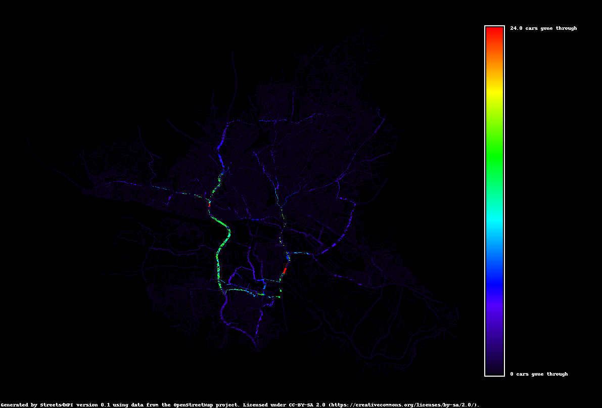
This visualization output shows the city of Hamburg, Germany, after some simulated traffic load. It uses the heatmap color mode.
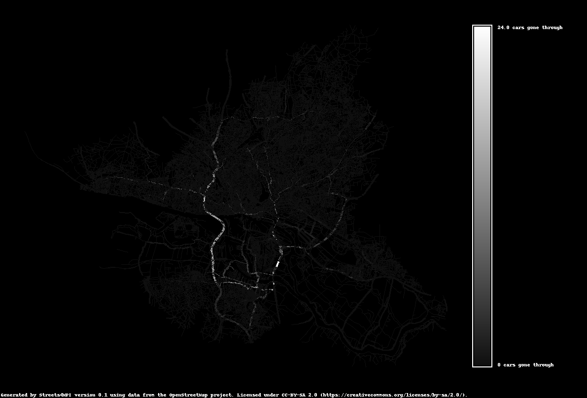
Using the same traffic load data, this visualization output uses the grayscale color mode.
When dealing with very large numbers of residents and/or street networks, Streets4MPI tends to use very large amounts of RAM and CPU time. We have performed tests up to 100,000 residents, and in some cases the simulation slowed down dramatically.
Unfortunately, Streets4MPI is not sufficiently tested for international map data. The simulation should be completely location-agnostic, but the visualization contains several “Hamburg-isms”, both explicit and implicit. We welcome any contributions to make our map projection more versatile.